We’re off to a great start to your weekend!

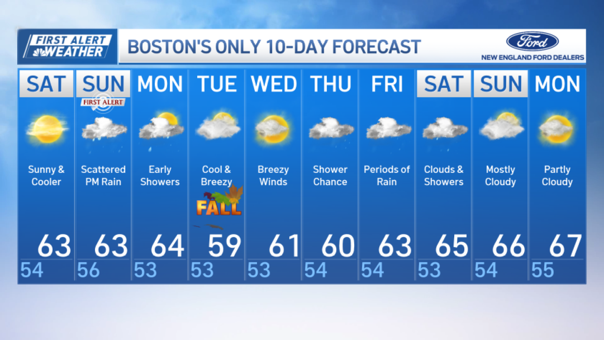
Today, we’re expecting mostly sunny skies across much of Greater Boston, but say goodbye to the summer-like temperatures for a while. In fact, an onshore flow will keep temperatures in the low to mid 60s in Boston this afternoon.
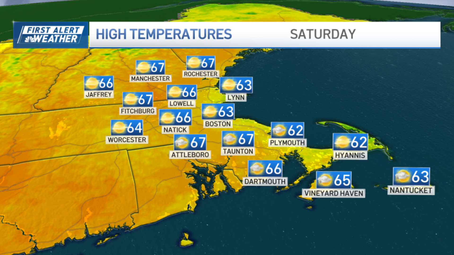
Low temperatures will drop into the lower 50s overnight. Also, be careful at the beach today. There is a high risk of rip currents from North Shore to South Shore and for the Cape and Nantucket.
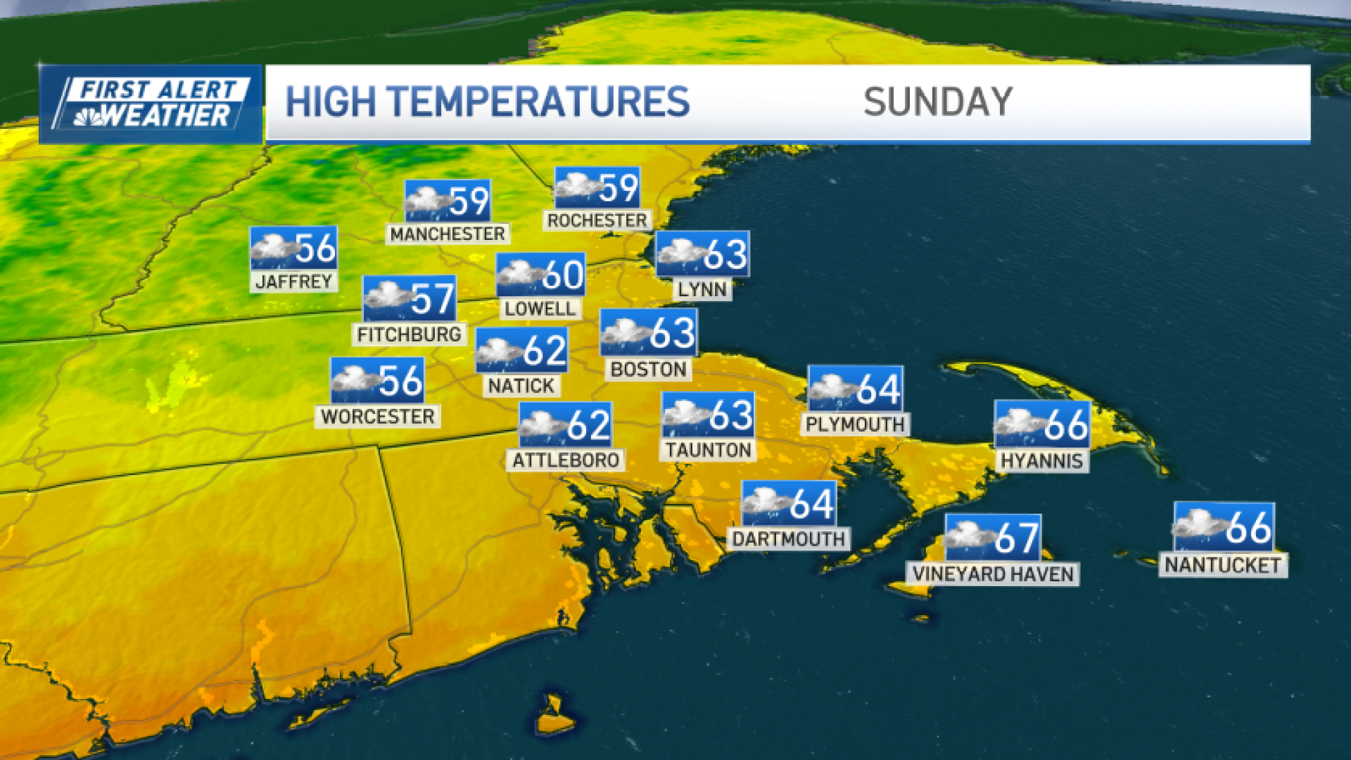
First Alert Sunday
By the time we roll into Sunday, big changes arrive.
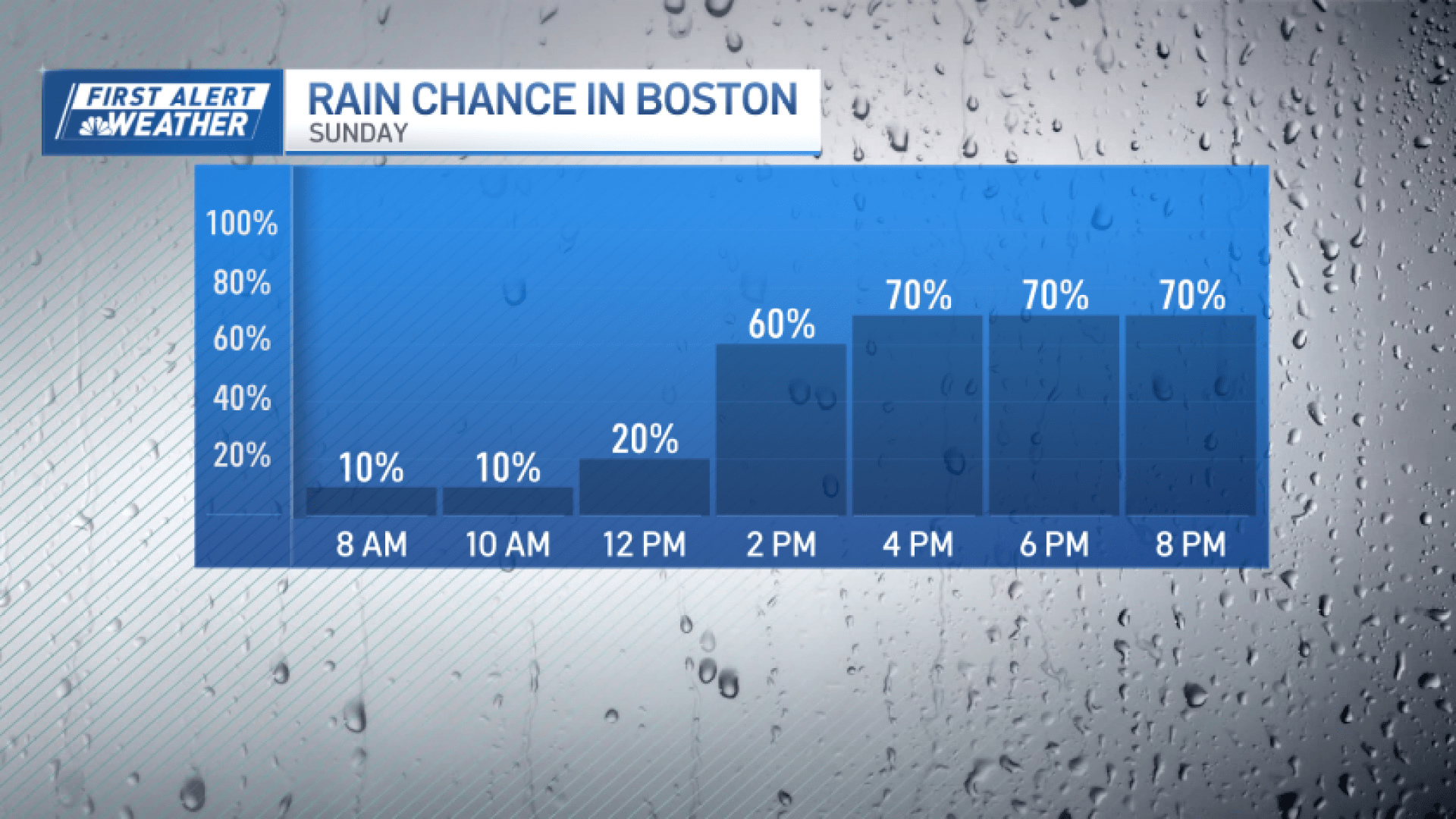
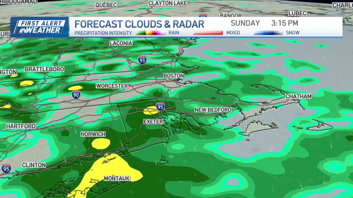
An area of low pressure to our west will bring widespread rain to much of our area, especially after Sunday afternoon and evening.
Some pockets of heavy rain are possible over southern New England, which could lead to localized flash flooding. That’s why Sunday is a First Alert.

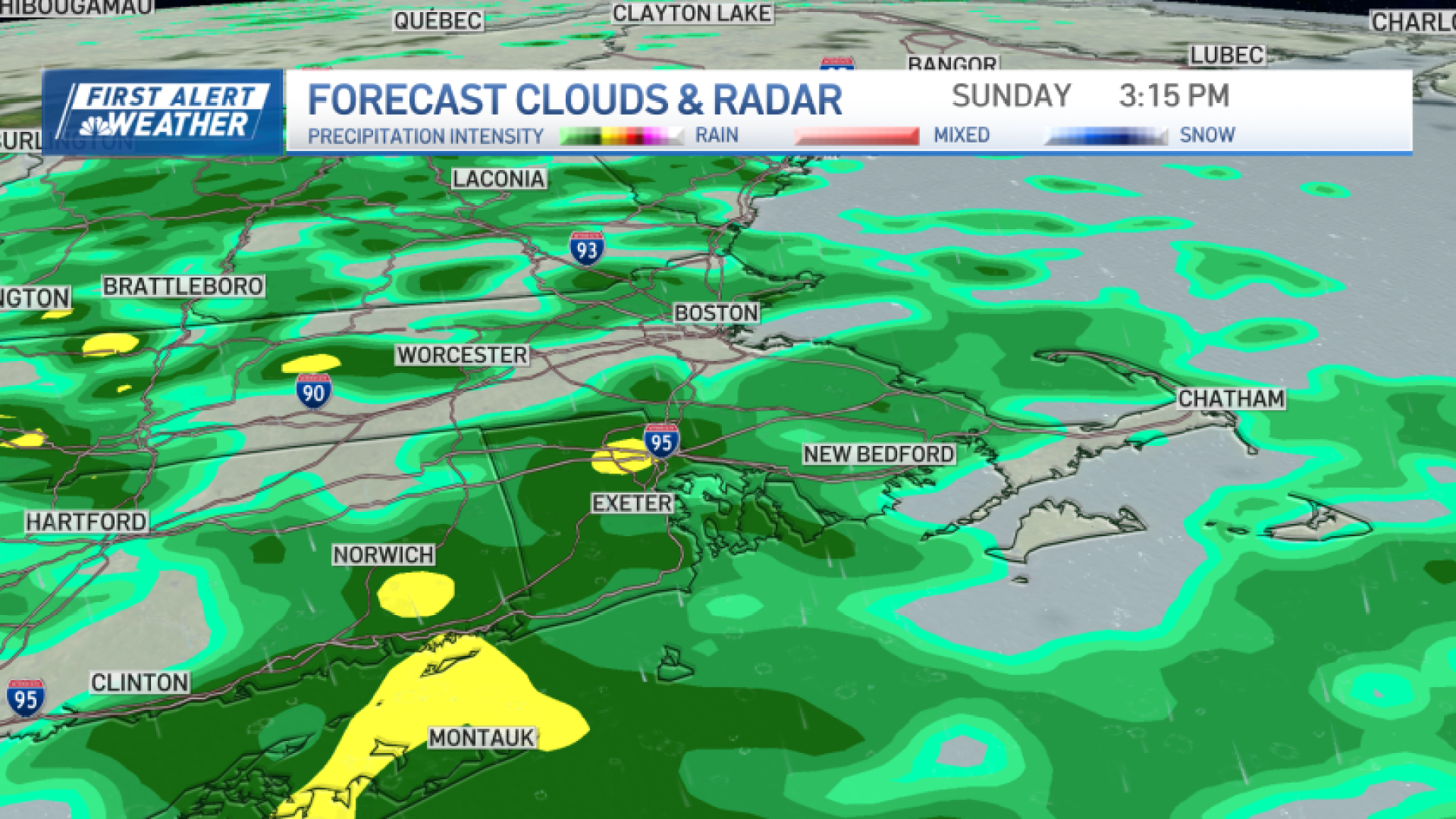
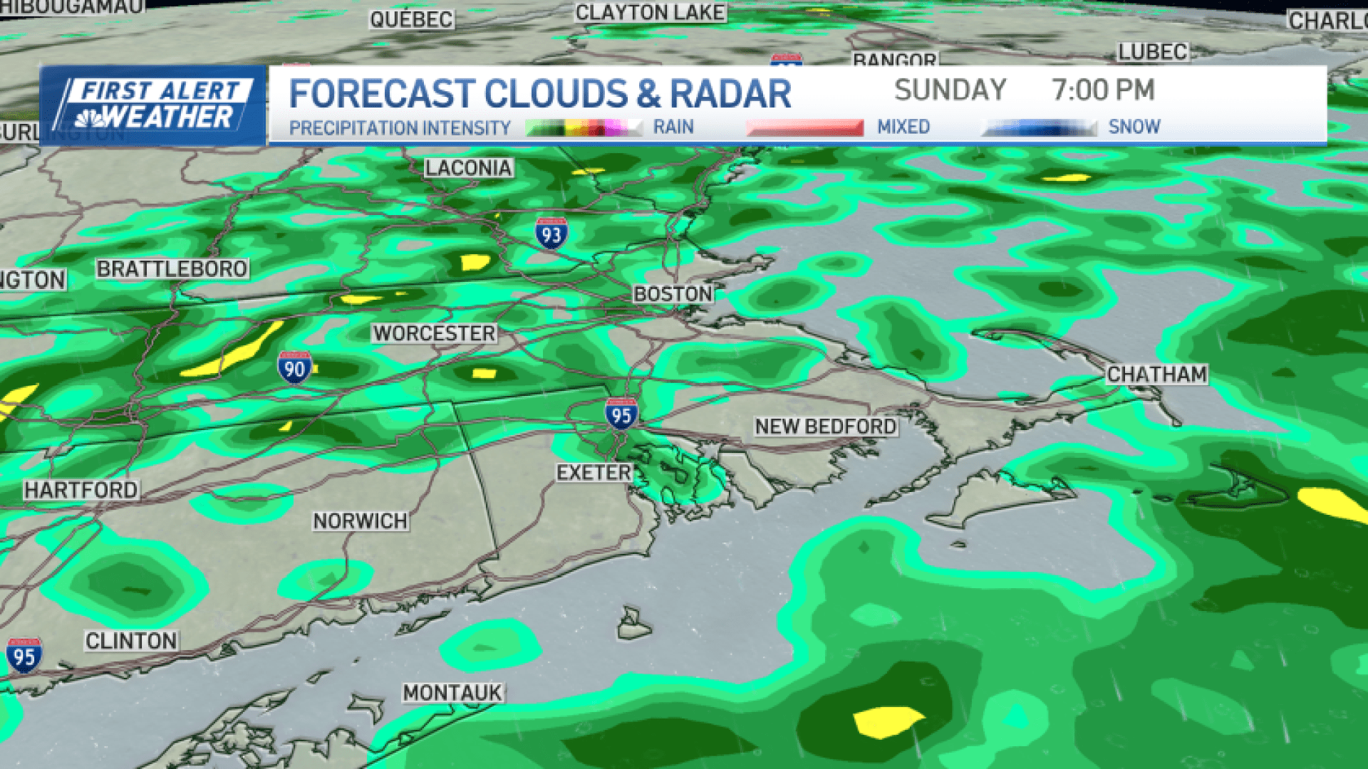
Be careful while driving Sunday afternoon and evening.
And if you’re going to Foxboro to cheer on our Patriots against the Steelers this Sunday, make sure you pack your rain gear, and consider wearing an extra layer. High temperatures will be low 60s on Sunday.

A few showers could linger into early Monday morning, but gradual clearing will be the rule through afternoon. Highs will be in the mid 60s.
The first day of fall arrives on Tuesday, with temperatures hovering near the upper 50s in Boston by afternoon!

While we’re talking about next week, our weather will remain a bit unsettled from Tuesday through next weekend as a front stalls near our region. We’ll need to watch the forecast closely. Some forecast models push clouds and a good dose of rain our way, especially late in the week into next weekend. Stay tuned for updates through the week. High temperatures will generally be in the low to mid 60s from Wednesday through Sunday.
Have a great weekend!